The Dunbar-Hunter Expedition was the first expedition sponsored by the US government into the Louisiana Purchase to return. This expedition gave the US government its first formal report of what the vast Louisiana Territory was like.
This expedition traveled from Natchez, Mississippi, to Hot Springs, Arkansas, and back. Their groundbreaking work provided the earliest scientific data on the area that is now Hot Springs National Park, as well as important ethnographic, biological, and geologic information for sites along the route.
Information for each principal city along the route locates the area within the story of the expedition. Links below each city provide resources for travelers. Use the links below to find the cities in alphabetical order or scroll down to follow the cities in outbound expedition order.
- Arkadelphia
- Camden
- Columbia
- El Dorado
- Hot Springs National Park
- Lake Catherine State Park
- Malvern and Rockport
- Monroe and West Monroe
- Natchez
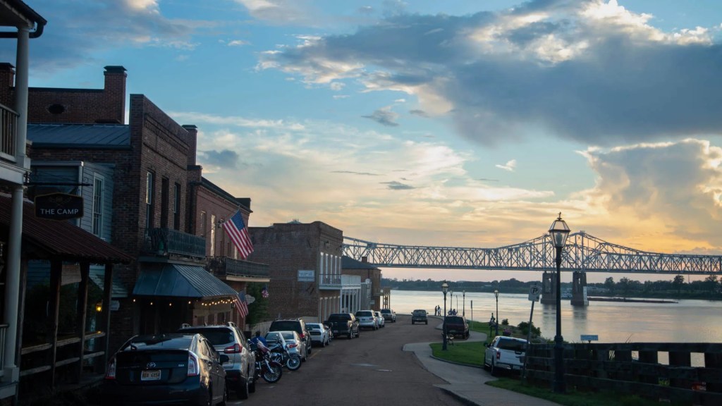
Source: Natchez Under-the-Hill Historic District – Visit Mississippi
Natchez
Natchez was the city nearest the plantation of William Dunbar and the launching point of both the Dunbar–Hunter Expedition (1804–1805) and the Freeman–Custis Expedition (1806). Named by the French for the Indigenous inhabitants of the area, the Natchez, this town became crucial for control of the lower Mississippi River. Before the Louisiana Purchase, it was the first American city on the Mississippi when traveling upriver.
South of Natchez along US 61, travelers can see the grave of William Dunbar in his family cemetery, and in the town of Woodville, see a marker honoring the history of the nearby site of Fort Adams.
Today, visitors to Natchez can explore this layered history at Natchez National Historical Park and along the Natchez Trace Parkway, which preserves routes long used by Native peoples, traders, and early American travelers. Together, these sites place the expeditions within a broader story of movement, commerce, and exploration in the Lower Mississippi Valley.
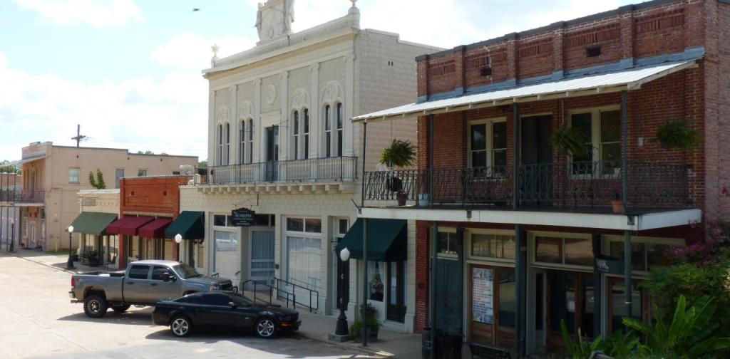
Columbia
Near Columbia, the Dunbar-Hunter Expedition turned a self-emancipating slave over to his “master,” a man named Innes. Innes had traveled from Alexandria, though it is not clear from which land owned by Innes that Harry had escaped.
Columbia is a small town that wears its river heritage proudly. Plaques near the water list steamboats that plied the waters of the Ouachita River in this area. A biking trail alongside the river and a riverwalk, both a short distance from downtown restaurants and shops, highlight the charm of this stretch of water.
Town of Columbia – The Little City of Happy Homes on the Ouachita
Source: Heron Hunt | Discover Monroe West Monroe
Monroe & West Monroe
Government on the Frontier
In 1804, the small settlement that is now Monroe was known as Fort Miro, after a Spanish fort built on that site. Constructed by Don Juan Filhiol, it was named after the Spanish governor of Louisiana. When Dunbar and Hunter arrived at the settlement in November 1804, its commander, Lieutenant Joseph Bowmar, had only taken possession of the area for the United States seven months before. The fort itself was on Filhiol’s private property, so Bowmar and his men were operating from hastily constructed fortifications nearby.
On their trip upstream, Dunbar and Hunter resupplied at the American fort and notably traded the unwieldy boat designed by Hunter for a smaller rented boat that could navigate the Ouachita better. On their return to Fort Miro in February 1805, the explorers traded in their rented boat for Hunter’s boat. By arrangement with Hunter, Dunbar left the group traveling downstream at Fort Miro to return to his plantation by horse.
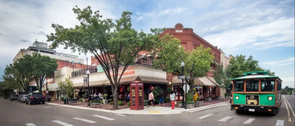
Monroe and West Monroe are still regional hubs today. Shoppers throng West Monroe’s Antique Alley searching for hidden gems, while at the Biedenharn Museum and the Masur Museum, visitors learn about the history of Coca-Cola and see world-class art, respectively. Many visit West Monroe’s Duck Commander, which offers warehouse tours and a gift shop, famous for its duck calls and the TV show Duck Dynasty.
El Dorado
The Dunbar-Hunter Expedition traveled along the Ouachita River close to El Dorado. They took note of a large bay, probably Moro Bay northeast of the city, where they met hunters with dogs who had caught a large bear. Today, Moro Bay is protected in Moro Bay State Park, where waterside cabins overlook Moro Bay and campsites overlook Raymond Lake. In El Dorado, South Arkansas Arboretum gives a sense of the varied plant life these explorers must have seen along easy-to-walk paths minutes from downtown.
El Dorado is known for its past as an oil boomtown. (Its name, referring to the fabled “City of Gold,” came about because oil is known as “black gold.”) That past can be seen in murals and statues about town, as well as at the Arkansas Museum of Natural Resources in nearby Smackover, another Arkansas state park.
Today, however, El Dorado is known for its flourishing downtown around a picturesque courthouse square, and for its Murphy Arts District (MAD), an entertainment district whose concerts bring big names to town.
Camden
Marking the Landscape
IThe site of Camden (Ecore a Fabri) was important long before Dunbar and Hunter traveled through this region. The Caddo Trace connecting to the Caddo on the Red River to the Quapaw on the Arkansas River. Don Juan Filhiol, Spanish commander of the Ouachita District, initially established his headquarters at Fabri’s Bluff in 1783 before relocating to establish Fort Miro (present-day Monroe, Louisiana).
Camden at the time was known as “Ecore a Fabri,” French for “Fabri’s Bluff.” Known as the Queen City of the Ouachita, Camden’s role as an important point on the Ouachita River continued into the Civil War, where five fortifications and a trench were constructed around the city. Two of those fortifications, or redoubts, still stand. One, Fort Southerland, is located in Fort Southerland Park. The city became the focus of the Camden Campaign late in the Civil War.
In the twentieth century, Camden was the birthplace of Grapette soda, which can be found in Walmarts throughout the United States and is also sold internationally. Two museums share the town’s past: the Chamber of Commerce, located in the historic Missouri-Pacific depot, and the McCollum-Chidester House, a museum operated by the Ouachita County Historical Society.
Open Visitors Page | City of Camden
Arkadelphia & Caddo Valley
Near Arkadelphia, the expedition encountered a hunter who showed them a saline spring. Dunbar and Hunter measured the density of the saltwater and calculated its specific gravity (that is, the ratio of the saltwater’s density to that of pure water). They found that the saltwater would yield a great amount of salt.
This finding was consistent with the later history of Arkadelphia. The area was known by the area indigenous peoples to have rich supplies of salt, a valuable resource both for cooking and meat preservation. The City of Arkadelphia, originally known as Blakelytown, formed to process this valuable commodity.
Though known primarily as a center for education today, Arkadelphia is proud of its roots, displaying pots used in Arkadelphia saltworks in front of both the Clark County Museum and the Clark County Courthouse.
Two tributes to the Dunbar-Hunter Expedition are located in Arkadelphia. One, located near the River Park Amphitheater, is near a site where the expedition camped. The other is located at the end of the DeSoto Bluff Trail overlooking the Ouachita River.
Nearby, Caddo Valley is named for the Caddo River that joins the Ouachita near the town. Visitors can stay at DeGray Lake on the Caddo, just upriver from where the explorers passed long ago.
Malvern & Rockport
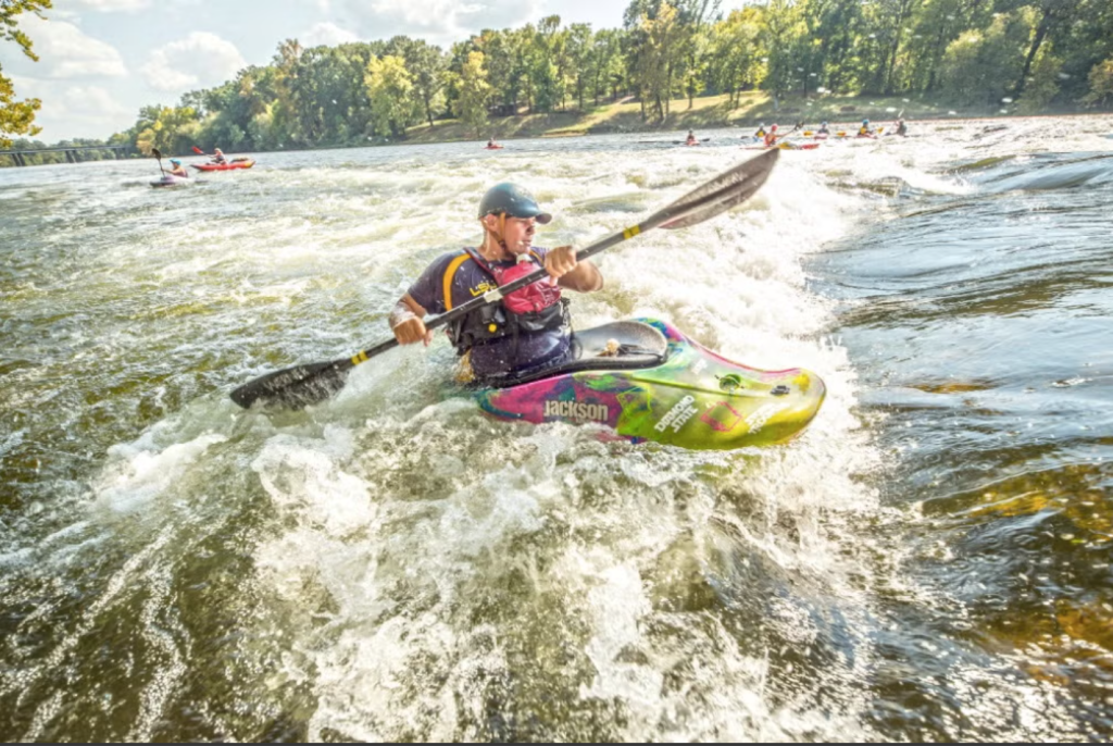
South of the point where I-30 crosses the Ouachita River, the Dunbar-Hunter Expedition faced the toughest challenge of their journey. The Chute, as Hunter and Dunbar called it, is formed of novaculite boulders emerging from the bed of the Ouachita River to create rapids. On December 3, 1804, it took the expedition hours to get their small boats through these rapids. It required a pulley and the manpower of most of the people in the exploring party. The novaculite boulders inspired the name of the town of Rockport. Today, Rockport is smaller than its neighbor, Malvern, but it bears a long and proud history. Its post office was established in 1837, making it one of the oldest communities in the state.
The nearby city of Malvern was established with the arrival of the railroad in the area. Its history has always been tied to the local geology. Bricks produced using local clay have earned Malvern the nickname “Brick Capital of the World,” and the novaculite which created such difficult conditions for the Dunbar-Hunter expedition is highly prized. Since before European contact, Indigenous tribes have used and traded the novaculite of the area for use as weapons and as tools, such as whetstones. French and American traders recognized the value of the area’s novaculite whetstones, and these whetstones from this area are today highly prized tools for professional craftspeople and hobbyists alike.
Today, visitors to Malvern and Rockport can enjoy the charm of downtown Malvern and try their hand at traversing “The Chute” at the Ouachita River Whitewater Park.
Malvern/Hot Spring County Chamber of Commerce
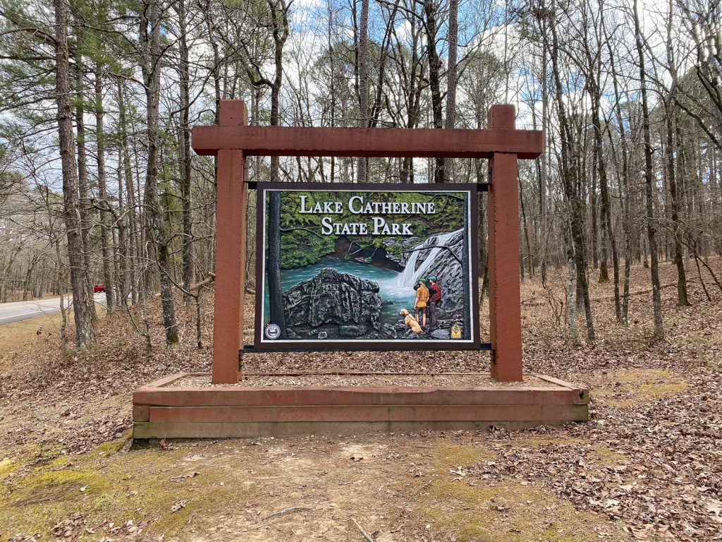
Lake Catherine State Park
Located between Malvern and Hot Springs, Lake Catherine State Park is a favorite spot for camping, hiking, horse riding, boating, and fishing formed by a hydroelectric dam on the Ouachita River. It was here, from a spot now believed to be underwater, that the Dunbar-Hunter Expedition established a basecamp for their exploration of the Hot Springs area.
Today, Lake Catherine State Park is open year-round as a place of outdoor recreation and interpretation. Trails and park staff-led programming help visitors understand the landscape of the region that once supported these early explorers.
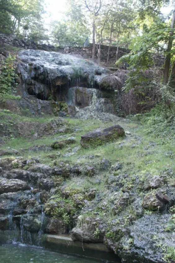
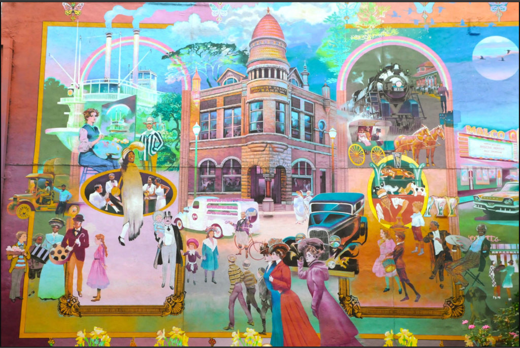
Hot Springs National Park
The destination of the Dunbar-Hunter Expedition is today the destination of thousands of visitors each year. Both groups are drawn by the thermal waters, today preserved within Hot Springs National Park.
The Dunbar-Hunter Expedition stayed in the Hot Springs area for a month, climbing on its mountains and studying its mysterious water. Hunter’s and Dunbar’s pioneering scientific study documented the temperatures of the springs and the existence of ostracods in the hot springs. (Ostracods are arthropods–distantly related to insects and spiders–that are thermophilic, which means that they are able to survive in extremely hot temperatures that would be fatal to other organisms.) The discovery of ostracods in this environment was one of the most noteworthy scientific finds of this expedition.
The City of Hot Springs National Park has a year-round appeal. Known as a place where athletes like Babe Ruth bathed alongside gangsters like Al Capone and Owney Madden, Hot Springs is a place awash in history as well as natural beauty. The Hot Springs Historic Baseball Trail and The Gangster Museum of America are just two of the attractions celebrating this city’s vibrant story. Other attractions, like Garvan Gardens, Mystic Ozark, and the Hot Springs Mountain Tower, provide outstanding opportunities to learn about nature.
Check out Visit Hot Springs to find out dates and times for signature events like the World’s Shortest St. Patrick’s Day Parade and the World Championship Running of the Tubs.
Diamond mining and quartz mining opportunities are available within short drives from Hot Springs. Nearby, Lake Ouachita is the largest lake in Arkansas. Lake Ouachita State Park has miles of hiking trails and, uniquely for Arkansas, provides opportunities to camp on islands within the lake.
